NEWS
As mild autumn weather lingers across the High Plains, long-range meteorological models indicate that Wyoming's first measurable snowfall of the 2026 season could originate thousands of miles away in the tropical waters of the Western Pacific Ocean. Weather forecasters and atmospheric scientists are tracking a powerful typhoon whose energy is expected to recurve into the North Pacific jet stream, triggering a downstream atmospheric domino effect that will drive cold air southward into the Northern Rockies.
The transition from a tropical storm to a high-altitude cold surge is a classic meteorological phenomenon known as downstream teleconnection. When a decaying typhoon moves northward out of the tropics, it injects vast amounts of heat, moisture, and kinetic energy into the upper-level polar jet stream. This sudden injection of tropical energy distorts the jet stream, creating a sharp, high-amplitude wave pattern across North America.
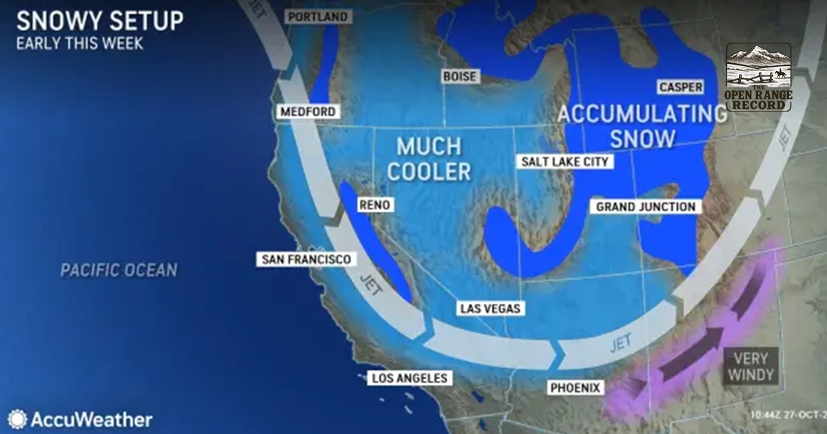
According to computer model guidance from the National Centers for Environmental Prediction, this atmospheric wave will force a dense ridge of high pressure into Alaska and Western Canada. On the eastern side of that ridge, a deep trough will carve southward, pulling a reservoir of cold Arctic air out of the Yukon Territory. As this Arctic cold front surges south across the Canadian border, it is projected to merge with a cut-off low-pressure system moving inland from the Washington coast.
The convergence of tropical energy, Pacific moisture, and Arctic cold air creates the ideal setup for a significant autumn snowstorm across Wyoming. When the cold front collides with moisture drawn ahead of the Washington low, atmospheric lifting across the Wind River, Big Horn, and Laramie mountain ranges will rapidly convert rainfall to heavy, slushy snow.
For Wyoming ranchers, agricultural producers, and transportation officials, the potential shift from mild October weather to winter driving conditions demands rapid preparation. Early-season snowstorms accompanied by sharp temperature drops pose severe risks to livestock, particularly herds still occupying higher-elevation summer pastures. Furthermore, heavy wet snow falling on un-harvested crops or trees that have not fully shed their autumn foliage can cause widespread timber damage and localized power outages.
Transportation corridors across the state, including Interstate 80 over Elk Mountain and Interstate 25 through the Shirley Basin, could face their first major winter travel disruptions of the season. High winds associated with the frontal passage often create severe ground blizzard conditions and drifting snow across elevated mountain passes, even during early autumn events.
While exact snowfall totals and precise geographic tracks will refine as the system approaches next week, meteorologists emphasize that tropical recurvature events frequently produce high-impact weather across the Intermountain West. If the projected alignment between the Pacific low and the incoming Arctic surge holds, Wyoming will owe its first winter storm of the year to the dying remnants of a distant Pacific typhoon.