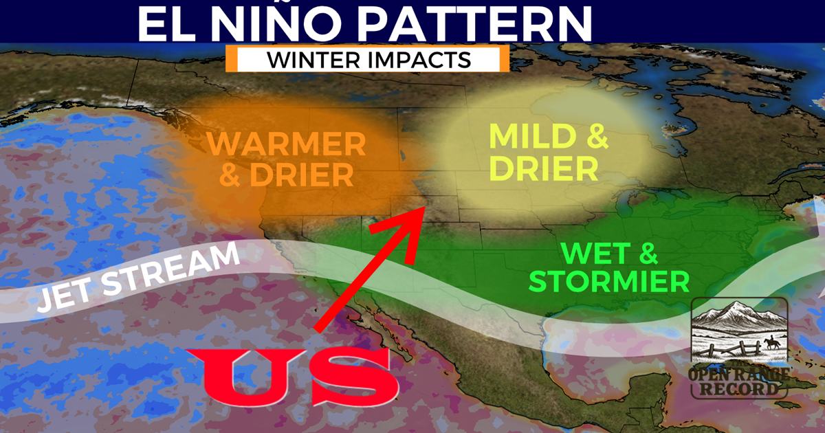
CHEYENNE, Wyo. : Meteorological data finalized last week confirms that the winter of 2025–2026 was the warmest in Wyoming’s recorded history. For the first time since record-keeping began in the late 19th century, six major Wyoming municipalities: Cheyenne, Sheridan, Jackson, Rock Springs, Evanston, and Sundance: simultaneously observed record-breaking temperature departures from their 60-year historical means.
The winter season, defined meteorologically as December 1 through February 28, defied traditional expectations of a La Niña cycle. Instead of the typical Arctic incursions, the state remained under a persistent high-pressure ridge. Atmospheric scientists are now correlating this phenomenon with a period of peak solar activity that has effectively overridden terrestrial weather patterns.
City-Level Data Breakdown
According to the National Weather Service (NWS) and the Wyoming State Climate Office, the temperature anomalies were most pronounced in the northern and high-elevation regions.
|
City |
Winter Avg Departure (F°) |
Record Status |
Key Observation |
|
Sheridan |
+11.2° |
#1 Warmest |
44 days over 50°F; nearly half the winter season. |
|
Jackson |
+12.2° (Dec) |
#1 Warmest |
January mean temp was 18.9°F (Historical avg: 15.5°F). |
|
Cheyenne |
+8.9° |
#1 Warmest |
Surpassed the "Dust Bowl" record of 1933-1934. |
|
Rock Springs |
+9.4° |
#1 Warmest |
Record "snow drought;" Jan precipitation only 0.11". |
|
Evanston |
+8.1° |
#1 Warmest |
Persistent winter rain events replaced typical snowfall. |
|
Sundance |
+10.5° |
Top 3 Warmest |
High-pressure "heat dome" stalled over NE Wyoming. |
The Solar Maximum: A "Top-Down" Forcing Mechanism
A central focus for researchers this season has been the intensity of Solar Cycle 25. Sunspot numbers throughout the winter consistently hovered between 200 and 300, far exceeding the 2019 consensus predictions of 115.
A pivotal event occurred on January 19, 2026, when the Sun emitted an X1.9-class solar flare, triggering a S4 (Severe) Solar Radiation Storm. This event produced auroras visible as far south as the equator. Data suggests a lag effect of approximately two to four weeks between this solar flux and terrestrial weather shifts.
Scientific modeling from the American Meteorological Society (AMS) indicates that increased Ultraviolet (UV) radiation during a Solar Maximum is absorbed by the stratosphere, warming the upper atmosphere. This warming displaces the polar jet stream. In the 2025–2026 season, this forcing locked a high-pressure ridge over the Rocky Mountains, preventing the Polar Vortex from descending into Wyoming.
Predictive Failure: The Divergence of Traditional Forecasts
The unprecedented warmth has also highlighted a growing gap between traditional seasonal forecasting and the reality of a high-solar-activity environment. Regional forecasters, most notably Don Day of DayWeather, whose reports are a staple for Cowboy State Daily readers, have faced significant challenges in accuracy over the last two winter cycles. While Day and other traditionalists leaned heavily on the weak La Niña signal, which historically suggests a colder, snowier northern Wyoming, the atmosphere behaved in the exact opposite manner.
The reliance on ENSO (El Niño-Southern Oscillation) data as the primary driver for long-range outlooks has proved insufficient when faced with extreme solar flux. For the second consecutive year, the arctic blasts and persistent snow predicted in seasonal outlooks failed to materialize. The solar-driven atmospheric blocking proved to be the dominant force, rendering traditional terrestrial models obsolete.
Ongoing Anomalies and the March Surge
The trend shows no signs of subsiding as the state enters spring. Just last week, a major solar flare and Coronal Mass Ejection (CME) struck Earth, generating a G4 (Severe) Geomagnetic storm. This latest surge of solar energy has coincided with a late-March heatwave across the High Plains, with temperatures in Cheyenne and Casper reaching levels more typical of late May.
The winter of 2025–2026 represents a definitive break from the 60-year historical trend. The data suggests that we are no longer in an era where Pacific Ocean temperatures alone can dictate a Wyoming winter. When the Sun reaches peak activity, its ability to manipulate the stratosphere can essentially cancel a La Niña, turning what should be a season of survival into a season of record-breaking warmth.
As the state faces a critical snowpack deficit and soil moisture levels 20-30% below normal, the focus shifts from the failed forecasts of the past to the hydrological reality of the future. Wyoming’s climate is increasingly being written not in the water of the Pacific, but in the fire of the Sun.

Reference Data for Fact-Checking
- Temperature Anomalies: National Weather Service (NWS) Observed Contextual Data, Winter 2025-26 Summary.
- Historical Means (1966-2026): Wyoming State Climate Office / Water Resources Data System (WRDS).
- Solar Activity (Cycle 25): NOAA Space Weather Prediction Center (SWPC) - Sunspot Index and Long-term Solar Flux Records.
- Solar Storm Event (Jan 19, 2026): NASA Solar Dynamics Observatory (SDO) X-Ray Flux Monitoring.
- ENSO Status: NOAA Climate Prediction Center (CPC) La Niña Advisory Records.
- Atmospheric Blocking Research: Journal of Climate/American Meteorological Society (AMS) - "Solar Forcing and Stratospheric-Tropospheric Coupling."